Ads by Google


CharacteristicNew ARM ArchitectureHost system with the new ARM-based 32-bit processor architecture, has higher processing speed, stronger real-time, lower power Consumption. Compatible with standard disk file system and USB protocols, the device becomes a disk, which has faster download speed and more convenient.
Dual-frequency Tracking, Multi-path Interference SuppressionSupplied by the international renowned company of NovAtel, the host board of F90 receiver adopts OEM card, which has 54 channels and can receive GPS satellite signals, GLONASS satellite signals, and SBAS signals. The use of PAC and Vision-related technology ,effectively eliminating multipath interference signals from the vicinity of the antenna or multipath interference environment, make the performance of our receiver more accurate, more reliable and higher data-collecting rate.
Combining the Radio and Network CommunicationThe series of F90 receiver syncretizes the industry-recognized UHF radio data-link technology with international standard and the network communication technology. According to the needs in the different field operation environment, the user has flexible choice.
Seamless Access to CORS SystemThe design of F90 receiver , depending on the technology of CORS and the network data transmission, guarantees the receiver can seamlessly access to the application of city CORS . Doing RTK surveying with only one mobile station, it is the best choice for CORS in mobile measuring.
Powerful Solution In Many FieldsThe software of F90 can satisfy the needs of your various projects, like real-time topographic mapping, powerline design, engineering stake, road stake, trace stake, reference-line stake, area calculation and perimeter calculation, and so on.
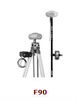
Simple and Compact DesignSmart and compact design. Combining with advanced receiver technology and system integration design, the receiver of F90, Maintains small size, light weight and low power consumption, convenient operation in the field.
SpecificationSatellite Signal L1/ L2/ L2C/ C/A /P code GPS GLONASS SBAS channel 54 channels Survey accuracy Static horizontal ±(2.5+1×10⁻⁶×D)mm Static vertical ±( 5+1×10⁻⁶×D)mm RTK horizontal ±(10+1×10⁻⁶×D)mm RTK vertical ±(20+1×10⁻⁶×D)mm Initialization time <10s Initialization reliability >99.99% RTD 0.45m Physical parameters Volume(Diameter x Height) 220mm x 120mm Weight 1Kg(include battery) Electrical parameters Host-board consumption 2.0W Battery capacity (2200 x2)mAh Working time RTK:10 hours,static:16 hours Recharge times Beyond 500 times Extra-power supply 9-16V DC Environment parameters Operation Temperature -20°C +75°C Storage Temperature -40°C +80°C Humidity 100% no condensation Waterproof Dustproof IP54 for submersion to depth of 1m,floating Shockproof Withstand 2m drop onto hard surface Performance parameters Interface Bluetooth,USB,serial port Data chain Radio Power 1-25W,adjustable ,channel can CDMA/GPRS set Communication Module Inside PDA parameters Size 144.25 x 82.25mm x 29.3mm Weight 0.3g(include battery) Microprocessor Samsung 2440,400MHz Operation System Windows Mobile RAM Memory 64MB Flash ROM 2GB Battery 2400mAh Lithium Rechargeable Operation Temperature -20°C +60°C Display 3.5”QVGA 262 x 144 pixel TFT